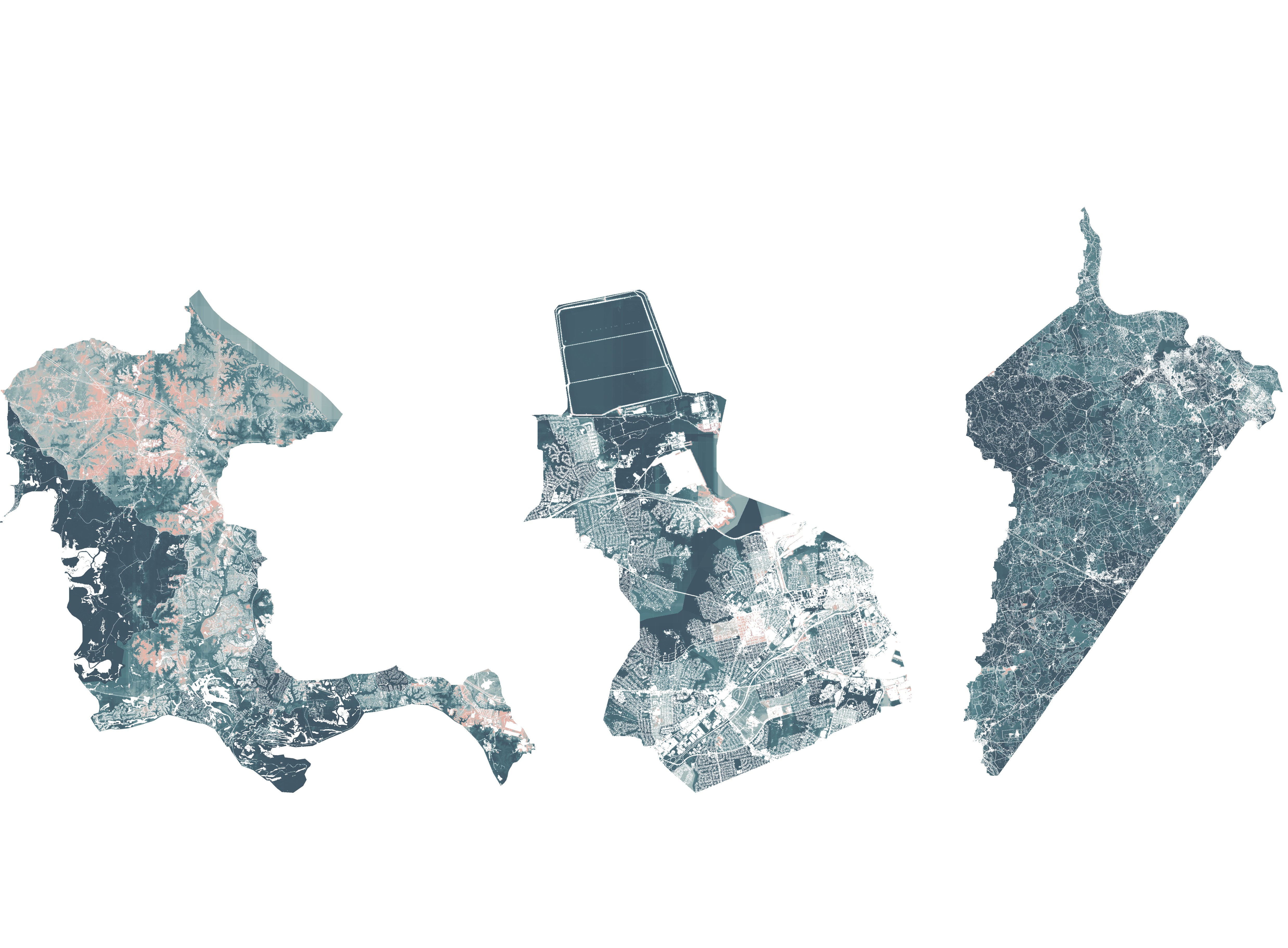
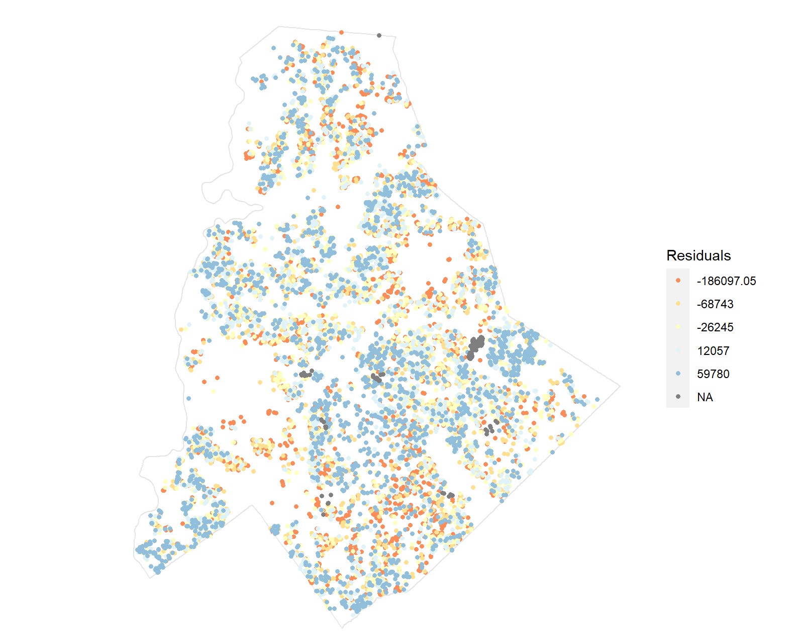
Precision Forecasts of Land Cover Change
By leveraging high-resolution longitudinal land cover data provided by the Chesapeake Conservancy, the model will predict land cover conversions from pervious to impervious surfaces. This forecast will enable land use and environmental planners to identify where urban growth will occur, propose green infrastructure accordingly, and prioritize lands for protection.
Geospatial Risk Prediction
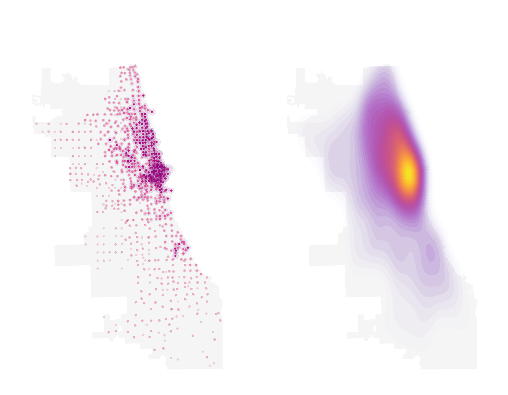
From 2021-2022 alone, the number of bike-sharing stations in Chicago has increased from 828 to 1,481. According to divvy, their site selection takes full account of the principles of EQUITY as well as SAFETY. The purpose of this study is to test the reasonableness of site selection.
Comparison Analysis of Escooter Usage in Chicago and Austin
Through exploratory analysis of the e-scooter dataset in Austin and Chicago 2019, and the census tract-based analysis model, we will be able to help decision-makers to identify more valuable investment areas, and better understand the motivation and behavioral characteristics of shared scooters users.
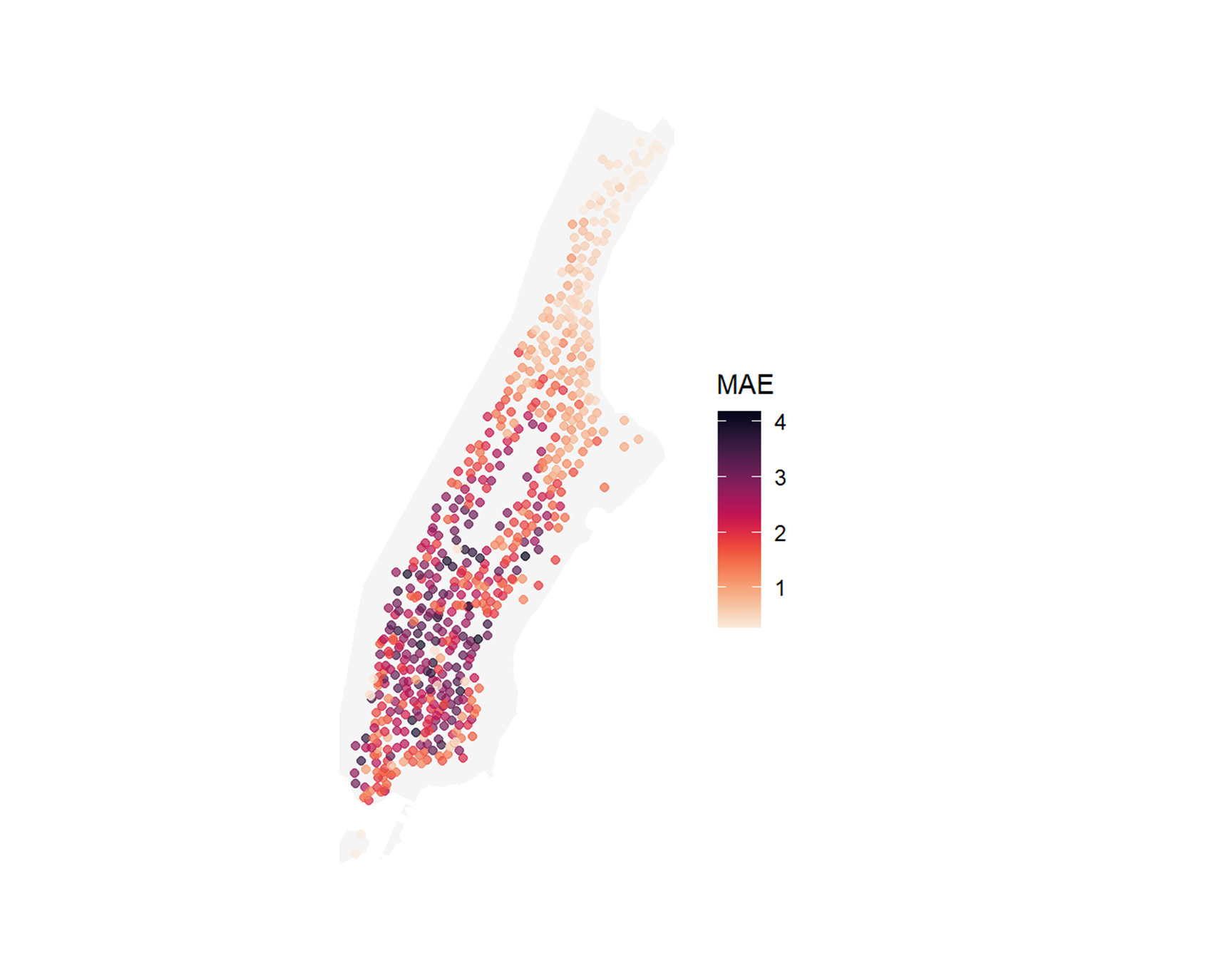
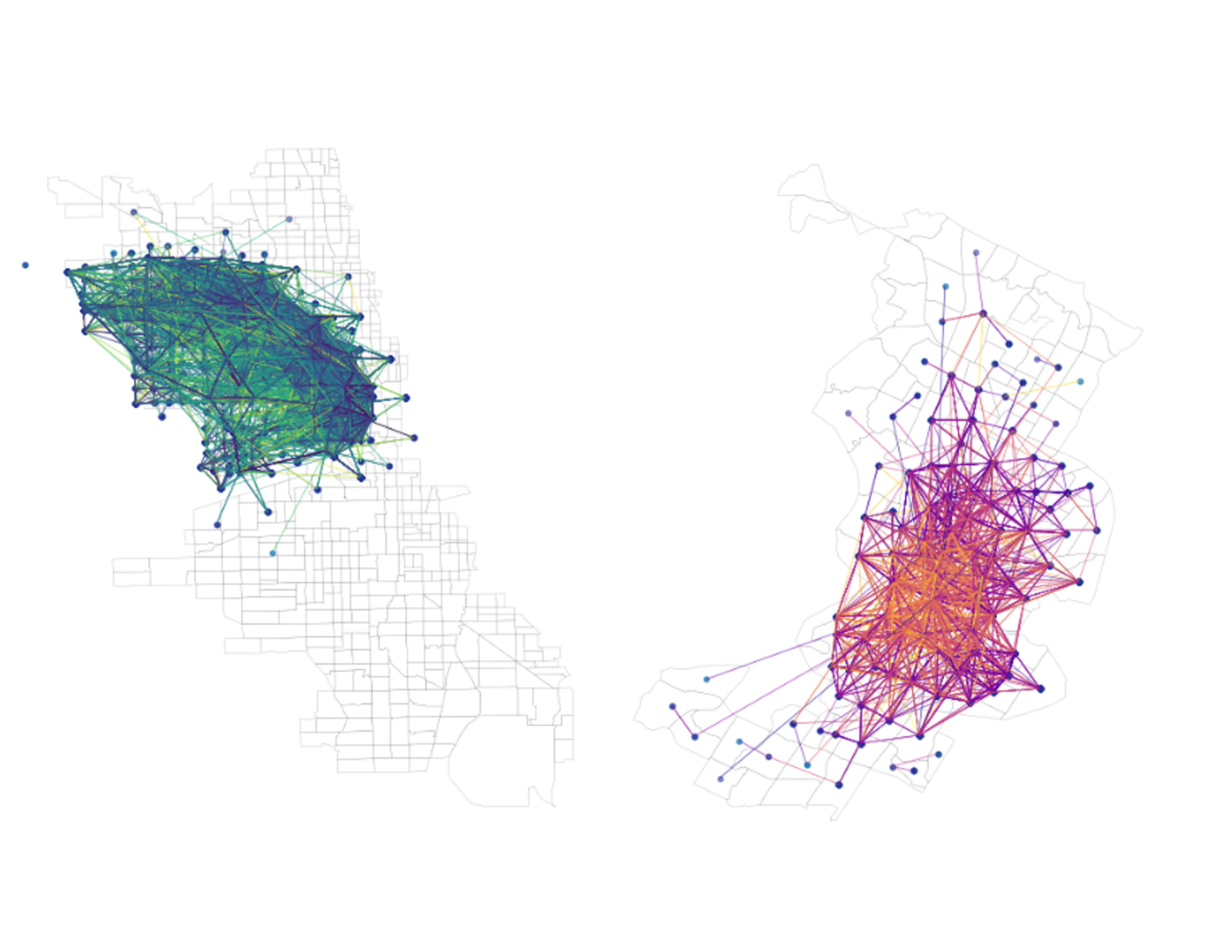
Ride Share Prediction in New York
In this analysis, I use the Citi bike usage data for April 2021 and try to build a predictive model for shared bike usage to help guide rebalancing.
Predicting Housing Prices in Charlotte
In this project, we refered to the hedonic home price model and the tier classification of zillow to build a house price prediction model for the new commer in Charlotte to find suitable houses in the city.
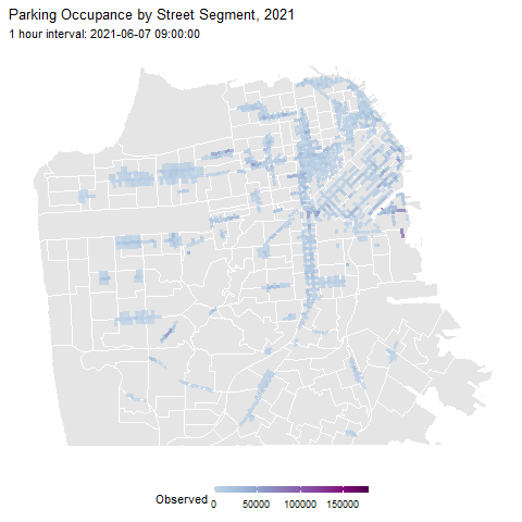
Parking Occupancy Rate Prediction
In this project, we designed an multiple linear regression algorithm based app called Super Finder to help local residents in San Francisco to find real-time empty spots in the city.
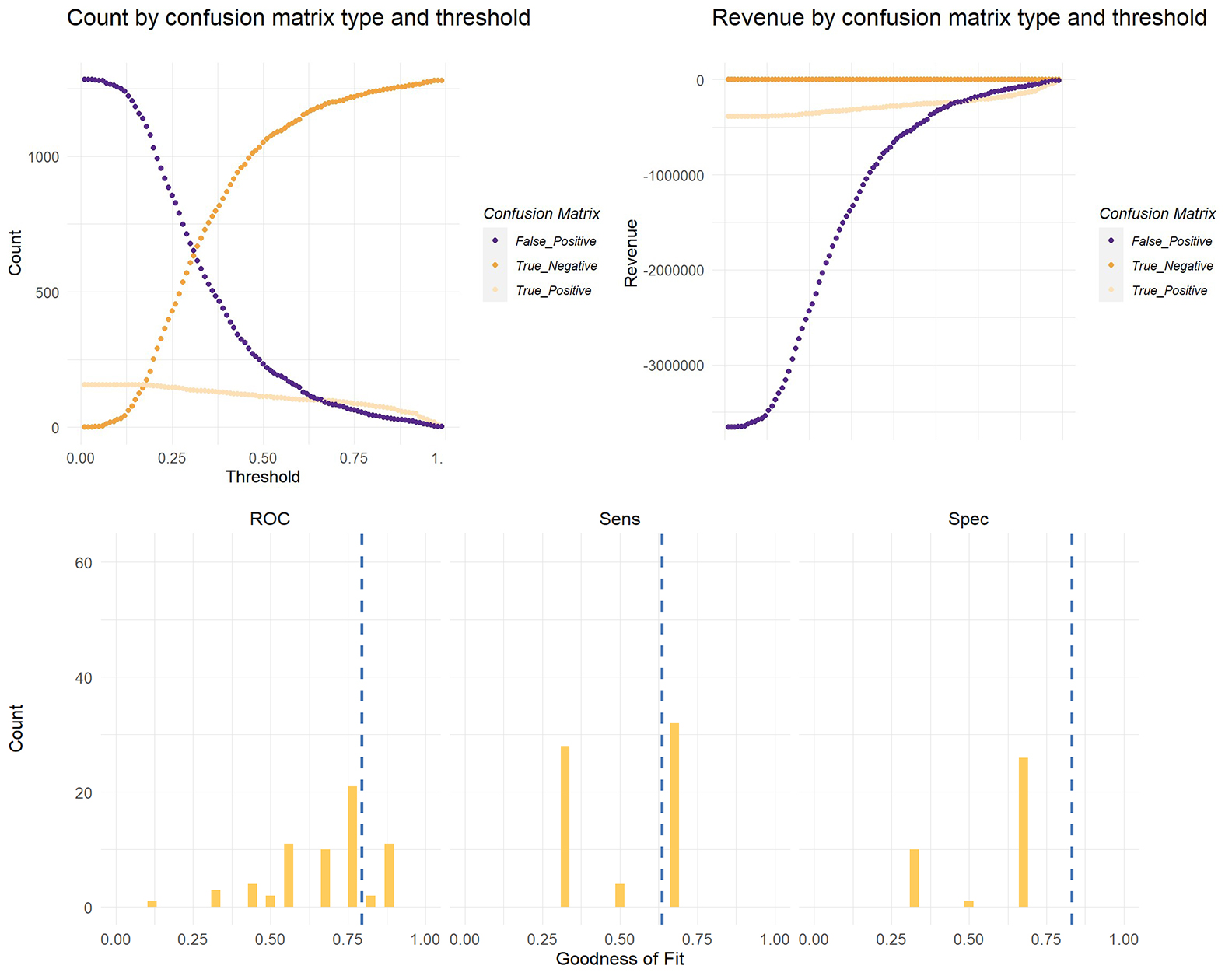
Targeting A Housing Subsidy
The purpose of this analysis is to model the Department of Housing and Community Development (HCD) by analyzing data from previous years' claims to receive the credit. With this model, Development (HCD) will better target policy populations and avoid ineffective financial expenditures and wasted resources.
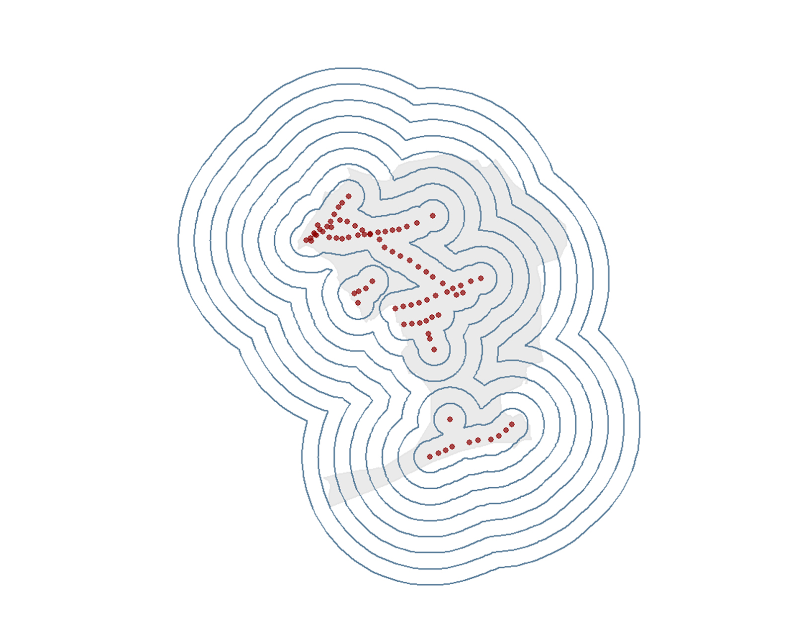
Transit Oreinted Development in Queens, New York, 2009-2020
This project aims to provide an overview to observe the changes in TOD and Non-TOD areas from 2009-2020 since the implementation of PlaNYC2030, and to illustrate the significance of identifying TOD areas for city development.